After becoming involved, against my better instincts, in an on-line forum on the subject earlier in the week, my thoughts returned to the pros and cons of charity challenges during a congenial weekend in North Yorkshire.
A captivating autumn day, engaging company, added to the treat of starting and ending our ascent of Whernside by the spectacular Ribblehead Viaduct; what wasn’t to like?
But while we took full advantage of our day, marvelling at the engineering skills of Victorian railway builders, taking our time on route to the summit – admittedly, because of my catalogue of recent injuries – while admiring the autumnal panorama, the majority of our fellow hikers appeared oblivious to the views and the location in their desperation to ascend and descend the hill within some set guideline for an organised charity event. And even on a November afternoon, there were still plenty of competitors about to ascend as late as 3pm.
But,so what? Surely we should be celebrating that so many people are out enjoying the great outdoors; particularly if they are raising money for worthwhile charities at the same time? Well, yes, but it is certainly debatable if everyone was enjoying themselves: the majority of the expressions suggested it was more of an ordeal.
Ingleborough in the Clouds
And, of course, with so many people involved – competitors climbing, then descending, three or four abreast, outside the assigned path, the litter, the vehicle support – we also move into the thorny issue of environmental damage and whether the money raised justifies the harm to the habitat and rise in emissions.
I have mixed feelings about charity challenges. While, in principle, I support any activities that get people out in the fresh air, get them fit and enable them to raise valuable funds at the same time, I also believe that any associated environmental damage must not be simply disregarded as an unfortunate, but less important, side effect.
In addition, I see little point of holding these challenges in beautiful places if the majority of the competitors are unable to appreciate the unique setting of the event. It the overriding objective is to complete a certain number of physical challenges within a specified time and, as a result, participants are too exhausted or too preoccupied to enjoy the locality, what’s the point of hosting it there? A physical challenge of this sort could just as easily be completed using cardio equipment in a gym.
Autumn in the Dales
Particularly culpable in this case is the Three Peaks Challenge where the three highest mountains on the British mainland have to be scaled within a strict time period, often 24 hours. As a result, the challenge is as much about the logistics of getting to the mountains in time, as it is about climbing them and, consequently, convoys of vehicles tear along motorways with teams of drivers and support staff, often disrupting local communities by arriving and departing in the middle of the night.
But I do not advocate the abolition of the Three Peaks. Instead, I suggest we make it a proper test where competitors would also be aware of, and able to enjoy, the beauty and challenges of the environment, with a much reduced carbon footprint.
Firstly, and most importantly, the 24 hour time limit would be abolished. Secondly, participants would have to arrive at their first peak and travel between the subsequent ones on foot, by bike, or by using public transport (including ferry if the challenge is extended to include Ireland). Thirdly, the time limits now imposed would be flexible and reflect the mode of travel and length of journey to the first mountain; days if travelling by public transport and an appropriate number of weeks if on foot, or by bike.
So, what do you think? Should charity challenges should be banned? Does the money raised for good causes outweigh any adverse effects? Any other suggestions?
Over to you…….
Autumn, in particular October, is ideal for a short break. But perhaps time and money are a bit short and you can’t spare more than a few days away; not enough to enjoy some sunnier climes?
Last Rays of Afternoon Sun
No problem, stay in Britain, make the most of the daylight before the clocks change, enjoy the changing autumn colours and, if the weather turns inclement, you can easily spend a day in a nearby city, or local attraction. Britain in autumn is perfect for a few days away where you can combine some cycling, walking, climbing, photography in the countryside, with a cultural, foodie, or chilled-out few days in the city.
One great advantage of our crowded island is that many of our major urban areas are cheek by jowl with national parks and areas of national beauty: think Sheffield/Manchester and the Peak District; Bristol and Exmoor; Glasgow and the Trossachs; Edinburgh and the Pentlands.
Autumn Colours
Even the sprawling West Midlands conurbation has the Malverns and the Cotswolds on its doorstep and woodland Surrey, the Chilterns and the south coast can be easily reached from Greater London.
But what to pack; particularly for us eco-conscious, self-sufficient travellers, who have to carry our needs for all eventualities on our backs, or bikes and on public transport? You need the footwear and outwear for protection in the great outdoors, but you don’t want to look like an outdoor gear geek as you sip your flat white in Convent Garden.
The key is, like with all packing, to try to take multi-purpose garments and, to be fair, the look, quality and weight of outdoor gear has improved immeasurably over the last few years. Merino wool tops, such as Icebreaker, look good enough to wear out or indoors, and merino also has the priceless asset of lasting several days without offensive odours. Similarly, ultra-lightweight down (and some man-made alternatives), like those by Rab, now are stylish enough, and in sufficiently pleasing shades, not to look out of place in city streets. And if it’s wet, wear your wet gear: if it throws it down, nobody cares much what you look like; hillside or city street.
Jurassic Coast in Autumn
This first “rule’ is generally to wear your “active” gear and footwear (usually because it’s the bulkiest) when you travel to your destination. This can result in some amusing scenarios: once, having secured a reasonably-priced first class ticket and resplendent in lycra and cycling helmet, I was initially blocked from entering the posh end of the train by an attendant who told me: “This is a first class coach madam.” When I replied that I had a first class reservation and offered to show him my ticket, he apologised and said: “I thought you were off on your bike, not travelling first class!”
Above Dunoon, Cowal Peninsular
So, other than specialised activity kit, what else to take?
Essentials: sleepwear, something to lounge about in, underwear and toiletries – if you’re staying in a hotel, b&b etc, it’s a good idea to check in advance what toiletries they provide as it can save considerable weight and bulk.
For trips of up to a week, I now organise my gear into: jeans/leggings, couple of tee shirts, tunic, sweater, comfortable lightweight shoes – obviously amend as appropriate.
Up to the Long Mynd
These I can pack into a small, lightweight wheeled bag, with waterproofs, hat, gloves, water bottles and the like in a 20 litre backpack. Thus, I can carry my luggage easily and have enough adaptable gear to keep me dry and warm on the hills, but stylish enough to look reasonably cool in a cafe, or shop, museum or cinema.
Go ahead, take advantage of the autumn kaleidoscope in the woodlands, enjoy the hills and mountains before winter sets in.
Autumn Sunset
But check out the exhibitions, movies and best eats in nearby cities as well to ensure you make the best of Britain this autumn. http://www.guardian.co.uk/travel/interactive/2011/jan/07/britain-best-budget-eats-restaurants-cafes has a really useful list of budget eats in towns and cities across the country: I haven’t tried them all, but those I have in Glasgow, Birmingham and Central London haven’t disappointed.
Some Boot and Bike recommendations for this autumn:
Exeter and the Jurassic coast: the city’s beautiful St Peter’s Cathedral is well worth a visit http://www.exeter-cathedral.org.uk/ and the Bike Shed Theatre http://www.exeterviews.co.uk/whats-on/event/74/henry-v.html presents a critically-acclaimed production of Henry V on October 21st-22nd.
The city sits at the west end of the Jurassic coast: the Dorset and East Devon Coast World Heritage Site is England’s first natural World Heritage Site – it covers 95 miles of truly stunning coastline from East Devon to Dorset, with rocks recording 185 million years of the Earth’s history http://www.jurassiccoastline.com/
Walk sections of the coastal path, visit the Swannery at Abbotsbury, marvel at Durdle Door rock arch, hunt for fossils on Charmouth beach, or take short detours to Bridport and Thomas Hardy’s Dorchester. And, you don’t need a car; instead use the excellent X53 bus that links Exeter with Poole at the easterly end of the coast http://lulworthcovebedandbreakfast.com/lulworth-cove/buses-jurassic-coast.htm
This is a question I’ve often considered, most recently on a day out in the Trossachs at the end of August.
One of the greatest assets of the Trossachs is that this unique, beautiful area is located so close to Glasgow, Edinburgh and Scotland’s urban belt. Certainly, the adaptation of steam power to land and water transport in the nineteenth century, helped with some publicity from, amongst others, Sir Walter Scott and Queen Victoria, opened up this spectacular area for the first time so visitors, of all social classes, could experience the fresh air and marvel at the dramatic scenery.
Thunderstorm over Loch Lubnaig
By the beginning of the twentieth century the railway linked Dunblane with Callander, through Balquhidder and Crianlarich en route to Oban. From Balloch it was possible to travel eastwards to Stirling, with a branch off to Aberfoyle, on a line that also linked Blanefield with the northern suburbs of Glasgow.
So, from then until the 1960s it was possible to travel by train from Glasgow, Edinburgh and the central belt right to the shores of the dazzling lochs Katrine, Voil and Lubnaig, the slopes of Ben Ledi or the heart of Rob Roy country and be able to complete a linear walk, or a cycle and enjoy a full day before a relaxing return in the evening: similar to what you can still do today using, say, the mountain railways of Switzerland. http://www.railbrit.co.uk/_maps/index.htm shows Scotland’s railway system at its zenith.
Of course, you can still easily reach these places today, but only if you have a car.
On my recent trip to the Trossachs I had to curtail an ascent of Ben Ledi just short of the summit because I could not risk missing an early evening bus from Callander to Stirling that linked with the specific Glasgow train I had a ticket for. Because of confused information about whether buses stop at the bottom of the climb along the A84, I had to walk the three miles or so from and to Callander; a frustrating culmination to what should have been an enjoyable day out and one that could only be attempted in the first place after a time-consuming and often frustrating internet search to find compatible trains and buses.
Although the climb would have been easily accomplished with access to a car, any personal convenience gained by driving would have been overwhelmingly offset by the negative environmental effects of pollution and congestion in an exquisite but fragile area; particularly when, as in this case, there was only one person travelling. And, even for those unaware, or indifferent to their emissions, crawling along narrow, congested roads is hardly the best way to enjoy the stunning scenery and driving to a destination generally makes it difficult to complete a linear walk, unless two vehicles are used.
Although the railways in the Trossachs are long closed, plenty of evidence of them remains and Sustrans, in particular, has performed a valuable service in acquiring and developing so many of these disused lines for cycle routes.
But, how much better if these tracks, and not just in the Trossachs, but in the Peak District, or Devon, or Galloway – think Ashbourne through to Buxton, all the way along the Tarka Trail, Dumfries to Stranraer along the glorious Galloway coast – still existed as railways? The benefits of enabling everyone, including those with limited mobility, to enjoy the Tissington Trail, or Glen Ogle viaduct would be sufficient justification, to say nothing of the opportunity to travel right into the heart of these alluring areas without congestion and driving stress – even the most hardened petrol head would be hard pushed to dispute the superiority of the view over Loch Lubnaig from the viaduct, as opposed to that from the busy and dangerous A84.
But, this isn’t going to happen, particularly in a country like Britain that can’t even operate its main line railways efficiently and economically. Even when inventive and valuable initiatives have been introduced, like the Trossachs Trundler (an adapted bus that could transport people and their bikes between various points in the Trossachs), they have invariably failed to break even and have been scrapped: in effect, the same short sighted, short term economic justifications that did for the railways.
What is needed is the opposite: long term, holistic, out of the box planning. Investment has to given to sustainable transport, combined with a workable system of rewards and penalties. If this means levying charges on motorists for parking and congestion to raise capital, then so be it; it is cars, after all, that cause congestion and pollution. And, if more restrictions and charges on cars lead to a more sensible attitude towards, say car sharing, so much the better.
Looking over Loch Lubnaig from the slopes of Ben Ledi
In the meantime, the best we can do is ensure we make the most of the routes that remain, by boot and bike, restrict and share car use as much as possible and continue to lobby for access for those who do not, or choose not to, drive.
Information:
The Trossachs Trundler was partially replaced by the introduction of Demand Response Transport (DRT) by Stirling Council http://www.incallander.co.uk/drtleaflet.pdf Taxis and minibuses, operated by www.aberfoylecoaches.com provide the transport in specific areas, arranged in advance, and passengers are charged the public transport rate for the journey. However, the vehicles (people carriers) are not adapted for carrying bikes and the requirement to book in advance clearly reduces spontaneity. Also, please note that the phone number used is an 0844 which will be charged at considerably more than standard rate, particularly from mobiles.
Spent a wet, but cheerful, couple of days in the Langdales last weekend, co-incidentally as the Lake District staged its Birthday Extravaganza to celebrate 60 years as a national park.
Although the rain and mizzle undoubtedly deterred some from attempting the rocks and summits, the lower paths were busy and the kaleidoscope of canvas (or whatever techno fabrics that have replaced it) in the camp sites, suggested that this summer’s staycationers won’t put off by a few showers either.
However, even a cursory, totally unscientific study of the ramblers and fell walkers on view would confirm what those of us who regularly hit the hills already know too well: the profile of the average fell walker is an uncomfortable reflection of the narrow social class who enjoy our national parks and the great outdoors generally.
Middle-aged, clearly at least middle income given the variety of mid-market outdoor labels on view, often grey-haired, several (impressively) well into their seventh and eighth decade, there were more Labradors and spaniels splashing about than anyone remotely under the age of 30. And, as for any black or brown faces, forget it: geographically Grasmere may be within 50 miles of Greater Manchester, but in terms of any similarity in ethnic profile, it may as well be on the moon.
OK, so walking only accounts for a percentage of visitors to the Lake District and other national parks and it’s a fair bet that those swinging from trip wires or paddling the rapids would be considerably younger. But, although there were several teenagers on off-road bike trails, many more riders were middle-aged and the profile of the roadies was very similar to their sliver-haired counterparts on motorbikes. And, everyone I saw enjoying any outdoor activity was white.
This is hardly an earth-shattering conclusion and it certainly does not add anything to what is already common knowledge. But, coming at the end of a week that exposed stark divisions within our society, shocking examples of disaffected young people and serious polarisation within sections of some major English cities, it is interesting to ask why so few young people, why so few from ethnic minorities and those who live in cities (of all ages) are represented in activities within our national parks and in the great outdoors generally.
Undoubtedly the Duke of Edinburgh Awards, inclusion schemes operated by schools, youth groups, the Prince’s Trust and others do a fantastic job in enabling some young people from all over the country, to gain self-confidence and the opportunity to work together and learn new skills in challenging situations, but they only touch the surface. The real tragedy is that groups currently under-represented in the great outdoors – whether from the inner cities, or the disabled, or ethnic minorities -are not able, or do not have sufficient interest, to enjoy some of our most beautiful places.
Far more thorough and academic investigations have been applied to why this is the case, but given that national parks were established in part following the historic campaign by working people in our industrial towns and cities to gain greater access to the countryside, it seems particularly sad that, today, so few inhabitants of those areas are benefiting from what their predecessors fought for.
But, while this problem has no one single cause, it is not too simplistic to highlight one obstacle that threatens to make the situation even worse. Although many national parks – particularly the Peak District – are situated near large, multi-ethnic conurbations, this does not mean that it is easy to get to them. Look round the car parks, or walk through Windermere, Ambleside, or Bakewell any weekend and it’s clear that to get to the heart of most national parks, or the countryside generally, you have to drive there.
Despite a few encouraging bus services, getting to a national park, then travelling around it by public transport requires, patience, determination and the ability to spend hours negotiating the internet (always assuming you have access to the web). Recent cuts to local services, plus more hikes in train fares have combined to make the situation even worse.
Arrochar Station: Gateway to Loch Lomond and the Trossachs
Difficulty in accessing rural areas is an issue that is routinely overlooked, despite being habitually cited as a major obstacle by groups currently under-represented in the countryside. Improving public transport to these areas, as well as having clear environmental benefits, might also go some way to enabling these excluded groups to visit and enjoy the countryside. Interestingly, recent figures showing a sizeable increase in passengers using small, scenic railways, such as Derby to Matlock and the Looe Valley line in Cornwall, suggest people are willing to use these options, where they exist.
Improving access to the countryside may seem like very small beer compared to the numerous other problems of the early 21st century, but increasing access and enabling more of our population to enjoy the great outdoors could have some important social benefits and might just result in a little less polarisation and disaffection elsewhere.
How? train from Glasgow Central (or Carlisle if travelling north) to Kirkconnel/Sanquhar, return buses from Wanlockhead/Thornhill/Carronbridge, if needed, run to Kirkconnel and Sanquhar
But: very isolated outside of the villages, can be bleak with high rainfall and infrequent transport, so vital to check timetables and plan in advance; proper equipment, sufficient supplies and spares are vital
Info: routes shown on maps; OS Explorers 320, 321, 328, 329
Terrain: steep gradients away from valley floor, often wet and muddy
Separated by the bleak and brooding Lowther Hills from its more famous neighbour, the Clyde, the River Nith follows a southerly course from its source in East Ayrshire to the Solway Firth. Best known for its excellent trout and salmon fishing and associations with Robert Burns, the majority of its valley lies in Dumfriesshire; from the bleak, open vistas of Upper Nithsdale, through a dramatic, gorge-like stretch between Mennock and Carronbridge – Highlandesque, in terms of its spectacular beauty – to the wide flood plain of Dumfries and thence into the Solway.
This is undiscovered Scotland; usually hastily bypassed on the M74 and West Coast Main Line 15 miles or so to the east. Undiscovered, of course, also means unspoilt and non-commercialised. But, linked by rail to Carlisle and Glasgow, with direct access to the Southern Upland Way and with world-class on and off-road cycling opportunities, it’s an excellent area for booters and bikers, with plenty of history, culture and even some foodie options thrown in.
Sunset over the Nith Valley
It’s also a remarkably easy area to get to: change at Carlisle – about four-five hours from London and around three from the Midlands on the West Coast Main Line – take the service to Glasgow via Dumfries and you arrive in Sanquhar/Kirkconnel (both villages have stations) in just over an hour. Similarly, the same service in reverse from Glasgow takes about 90 minutes.
Increasingly popular with off-road bikers as it’s right in the heart of the Seven Stanes series of world-class MTB courses, www.sevenstanes.org.uk this corner of SW Scotland is also ideal for road cycling and touring and every type of walking, from the most testing long distance footpath in Britain to riverside rambles http://www.uppernithsdale-events.org/walking A 15 mile trail focusing on the coal and lead mining heritage of the area has recently been opened linking Kirkconnel to Wanlockhead. It crosses rough moorland, with some spectacular views, but is strenuous, so proper equipment and hill-walking experience are necessary http://www.geolocation.ws/nearby/en?loc=55.420516,-3.823472
Although not renowned for copious amounts of sunshine – it can be bleak and cool even in the middle of summer – it is usually mild and the area’s plentiful rainfall results in a lush, emerald vista of deciduous woodlands and fast flowing streams (as well, regrettably the ubiquitous midges). It’s refreshingly untouristy and the evening light lingers long, from April right through to August.
The area, generally, is noted for its salmon fishing and, for admirers of Scotland’s national bard, it is smack in between Robert Burns’ birthplace near Ayr, and his grave and mausoleum in Dumfries.
St Conal's Cross
Definitely worth a look is the beautiful and historic church in Kirkconnel that dates from the early 18th century. However, the first church in the village is thought to have been established by St Conal in the eighth century. Closed down during the period of Covenanter unrest in the 1680s, a Celtic cross now marks the site, about two miles out of the village, and a recent renovation project has restored the site of the original kirkyard. http://www.kirkconnel.org/index.php?option=com_content&task=view&id=81&Itemid=211
Both Kirkconnel and Sanquhar have strong historic links with the Covenanters – people in Scotland who signed the National Covenant in 1638 opposing any interference by the Stuart kings in the affairs of the Scottish Presbyterian church. In 1680 the preacher Richard Cameron, issued the famous Sanquhar Declaration, renouncing allegiance to Charles II. This, and a second declaration in the town, by James Renwick five years later, set out the basis of future religious freedom in Scotland.
ii) walk/cycle from Sanquhar along minor roads and forest tracks to Kirkconnel and back – about 11 miles, off-road bike needed
From Sanquhar station go down Station Road, cross the A76, then straight head along Blackaddie Road. Cross the bridge and keep straight ahead. The road then follows Euchan Water past a lovely waterfall. The scenery is superb and after about two miles you will reach a coniferous plantation. Cross a ford (you may need to lift your bike over a gate here), keep on the track through the rest of the trees, descend to cross a burn and follow the track through the next plantation. Keep on the track until a cattle grid, turn right, cross another grid and then continue along the side of Corserig Hill. Keep going until the track splits, bear left on the well-defined path and follow this through Librymoor Plantation until you see Kirkconnel Cemetery in front of you. Turn right on to the minor road that runs behind Kirkconnel and continue on this for approximately three miles. At Blackaddie Bridge, turn left and follow the road back into Sanquhar.
Sanquhar - Kirkconnel - Sanquhar Off-Road
ii) cycle from Sanquhar to Drumlanrig Estate near Carronbridge – 17-20 miles, depending on route, off-road bike needed if riding the forest trails at Drumlanrig
Follow above directions from Sanquhar station to Blackaddie Bridge, then turn left and follow the minor road with the River Nith on your left; past Menock and Eliock Wood the valley is spectacular. At Burnmouth the road heads south, away from the river. Continue for about half a mile to Burnsands where you can either turn left and follow the road direct to Drumlanrig Castle (about 2-3 miles) or go straight on for about five miles, where the road then loops round back to Drumlanrig. http://www.drumlanrig.com/drumlanrig-outdoor-activities/cycling
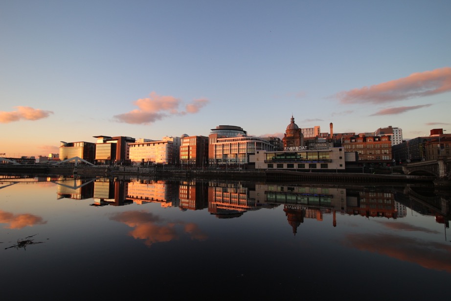
A wealth of culture, some of the finest art and architecture in Europe, a shopping mecca, vibrant nightlife: just some of Glasgow’s best known features. But, alongside these attributes, its marvellous location for walking, cycling, sailing and numerous other outdoor activities is all too often overlooked.
A city infamous for poor health and housing and blighted by its planners in the mid 20th century, Glasgow, which means Dear Green Place, has, surprisingly, more green spaces per head of population than any other conurbation in Britain, with beautiful parks to be found all over the city. And, within an hour of its centre, you can be climbing a Munro, cycling along Loch Lomond,or sailing in some of the world’s most beautiful coastal waters. This fairly unique combination makes the city ideal to shop till you drop, enjoy many varied forms of culture, but equally easily escape to the great outdoors that are literally on your doorstep.
In addition, the city has an excellent public transport system; in terms of connecting areas and scope, second only to London. And, given Glasgow’s location, its commuter lines actually reach some of the most scenic and iconic places; for example, Balloch, at the foot of Loch Lomond, is around 40 minutes out of the city on a twice-hourly service, whilst the legendary West Highland line, reaches Arrochar and the northern end of Loch Lomond at Ardlui in about an hour.
It is this mix of unique location, plus easy availability of public transport, that makes Glasgow such an ideal base for a boot and bike trip.
Get there and about:
Virgin Trainswww.virgintrains.co.uk travel to Glasgow from London, the Midlands and North West England on the west coast main line; journey times are about five hours from London and just under four from Birmingham.
Strathclyde Passenger Transport www.spt.co.uk is responsible for city and suburban trains, buses and subway.
Scottish Citylink coaches www.citylink.co.uk run out of the city along the A82 en route to Fort William, Portree and Oban.
Loch Lomond Cruises www.cruiselochlomondltd.com operate a ferry service from Tarbet across the loch to Rowardennan and Inversnaid, between April to October.
Stay at:
Glasgow Guest House
Glasgow Guest House www.glasgow-guest-house.co.uk enjoys a great location on bus routes, five minutes from Dumbreck rail station, within walking distance of the subway, virtually next door to Mackintosh’s House for an Art Lover and 20 minutes walk from the Burrell. It’s clean, welcoming, serves brilliant breakfasts, has a residents’ kitchen and ample and secure storage for boots, bikes and equipment: Glasgow with hospitality, humour and style.
Make sure you see:
Merchant City
Architecture; Look out for Charles Rennie Mackintosh’s buildings and designs www.crmsociety.com Alexander”Greek” Thomson’s buildings www.greekthomson.org.uk There is a wonderful Victorian legacy throughout the city and the magnificently-renovated 18th century Merchant City www.merchantcity.com is also a must-see.
Art; Kelvingrove Art Gallery and Museum, Museum of Modern Art, Burrell Collection and Pollok House
Pollok House
Museums and Culture; Kelvingrove, Tenement House, Cathedral, People’s Palace, new Riverside Museum of Transport with the Tall Ship and any of the 13 major museums in the city www.seeglasgow.co.uk
Music; King Tut’s, O2 Academy, Royal Concert Halls, Theatre Royal, SECC
Film; Glasgow Film Theatre and Grosvenor, numerous multi-screens
Theatres; King’s, Citizen’s, Tramway, Arches, Theatre Royal, Tron and many more
Great ethnic restaurants in Merchant City and West End.
Bars and restaurants in Ashton Lane, near the university in the West End.
Good value food and drink at The Left Bank www.theleftbank.co.ukand The Two Figs www.thetwofigs.co.uk in the West End.
Best coffee at Tapa in Denniston and Southside, www.tapabakehouse.com
Cute cafe and pastries at Cranberry’s in Merchant City.
Willow tearooms in Buchanan and Sauchiehall Streets for some Mackintosh-inspired refreshments www.willowtearooms.co.uk
Shop till you drop:
Buchanan Street; John Lewis, House of Fraser and just about everything else
Italian Centre
Italian Centre in Merchant City, Princes Square and Royal Exchange Square; more upmarket labels
Byres Road, Ashton Lane in West End; small boutiques and more bohemian options
Out of town retail centres; include Braehead and The Forge
SOME SUGGESTIONS FOR DAY TRIPS OUT OF TOWN: Coast, Mountains, Lochs, Culture and History using boot, bike and boat and public transport.
Coast:
Where? Ayrshire Coastal Path,Dunure to Ayr
How? train from Glasgow Central to Ayr, www.firstscotrail.co.uk bus to Dunure, www.travelinescotland.co.uk walk back to Ayr
Why? fabulous coastal views of Arran and Argyle, cute little cafe and inn at Dunure, interesting, short diversion to Burns Cottage in Alloway
But; potentially dangerous tides in places, really do need guidebook and cannot rely on maps and signposting
Info; OS Explorer 326, www.ayrshirecoastalpath.org for details and guidebook
Directions; walk down to harbour from bus stop in Dunure, then follow route signs north. BEWARE of tides, particularly in Bracken Bay and do refer to guidebook as signposting is very obscure in places
Distance; 9 miles direct, about 11 with detour to Burns Cottage
Terrain; difficult in places, rocky outcrops, sandy beaches, field paths
Refreshments; Dunure Inn www.dunureinn.co.uk Dunure Harbour Coffeeshop www.harbourviewcoffeeshop.co.uk extensive selection of cafes and restaurants in Ayr
Hills:
i) Where?Beinn Dubh Horseshoe from Luss on western side of Loch Lomond
How? Citylink coaches from Buchanan Street bus station to stop on A82 next to start of route www.travelinescotland.co.uk
The Arrochar Alps
Why? good workout for Munros, great views of Arrochar Alps, easy access, refreshments in pretty, conservation village of Luss
But; allow enough time to complete the horseshoe and plan carefully to synchronise with buses, particularly in summer when you need to book seats on specific services
Info; OS Explorers 364, 367, Harvey Superwalker 1:25,000 Glasgow Popular Hills www.harveymaps.c.uk Glasgow, 40 Town and Country Walks, www.pocketmountains.com
Directions; walk from bus stop towards footbridge over A82, go past house on right, through metal gate into field, follow route from here
Distance; 7 miles
Terrain; hill paths, steep climb, boggy in places
Refreshments; Colquhoun’s, The Lodge on Loch Lomond Hotel www.loch-lomond.co.uk Farm Milk Bar, Car Park, Luss, The Coach House Coffeeshop www.lochlomondtrading.com
ii) Where?Conic Hill at southern end of Loch Lomond
Why? wonderful views only usually enjoyed from much higher aspects, ideal to fit in for morning/afternoon, or for a winter walk
But; shares some of access route with West Highland Way and can be busy, especially in holiday periods and in spring dog-walkers cannot access the high moor behind the hill
Info; OS Explorer 347, Harvey Superwalker 1:25,000 Glasgow Popular Hills www.harveymaps.co.uk Glasgow, 40 Town and Country Walks, www.pocketmountains.com
Directions; path starts from Visitor Centre in Balmaha where bus terminates, follow the well-signposted route and good path to the top of the hill
Distance; 3 miles
Terrain; woodland and hill paths, steep in places
Refreshments; Oak Tree Inn in Balmaha www.oak-tree-inn.co.uk village shop next door also sells hot drinks and sandwiches, as well as provisions
iii) Where? Dumgoyne Hill, Blanefield, north of Milngavie
How? bus (no10) from Buchanan Bus Station to Blanefield (hourly during most of the day)
Dumgoyne
Why? more fantastic views to southern aspects of Loch Lomond, Arrochar Alps, Ben Lomond and more, from a steep, but short, climb, within easy reach of city centre
But; very boggy in places, have to jump across a couple of burns en route
Info; OS Explorer 348, Harvey Superwalker 1:25,000 Glasgow Popular Hills www.harveymaps.co.uk
Directions; start from war memorial in Blanefield, carry on up Campsie Dene Road to Cantywherry Cottage, then take path to the right up the hill
Distance; about 6 miles
Terrain; hill paths, boggy and muddy, steep in places
Refreshments; nice deli with lovely little coffeeshop www.pestleandmortar.com across from bus stop in Blanefield
iv) Where? Loch Humphrey and Duncolm, Kilpatrick Hills, west of the city
How? train to Kilpatrick from Glasgow Queen Street or Central
Erskine Bridge from Loch Humphrey
Why? extensive views over the city from a surprisingly remote, heather-clad range of hills very easily accessible from the city
But? bleak and isolated on the hilltops, steepish climb to the Loch
Info; OS Explorer 347, Harvey Superwalker 1:25,000 Glasgow Popular Hills, www.harveymaps.co.uk Glasgow 40 town and Country Walks, www.pocketmountains.co.uk
Directions; from the railway station head along the road under the A82 road bridge to Kilpatrick Gasworks, then follow the track signposted Loch Humphrey. At the loch keep on the obvious path, passing Little and Middle Duncolm before climbing to the summit of Duncolm
Distance; about 8 miles
Terrain; tarmac stretch at start, then rough heather and bracken, boggy in places on hillside
Refreshments; none on direct route, pubs and shops in Kilpatrick
Munro:
Where? Ben Lomond
How? train from Glasgow Queen Street to Arrochar/Tarbet, Cruise Loch Lomond www.cruiselochlomondltd.com from Tarbet Pier across loch to Rowardennan (April-October), leaving Tarbet at 10am, returning from Rowardennan at 16:45
Ben Lomond
Why? great way to climb Scotland’s most southerly Munro on day trip from city without having to drive
But; absolutely vital that you have sufficient hill-walking experience/fitness to complete the climb and descent before return sailing
Info; Harvey Superwalker 1:25,000 Glasgow Popular Hills www.harveymaps.co.uk OS Explorer 364, 347
Directions; follow clear route to the mountain from car park in Rowardennan
Distance; around 7 miles
Terrain; tough mountain climb, remote and exposed in places
Where? Ben Arthur (The Cobbler), overlooking Arrochar
Why? One of Scotland’s iconic mountains, yet within easy access of the city, stupendous views of Ben Lomond and other peaks in the Trossachs, lochs Lomond and Long How? Train from Queen Street, or bus from Buchanan Bus Station www.citylink.co.uk to Arrochar But: very steep last section to exposed summit where slabs can be very slippery; liable to be cold, windy at higher levels irrespective of conditions at start; proper equipment, clothing and adequate fitness essential; limited train service and seats on return bus journey often need to be booked in peak months, so check timetable carefully to avoid a long wait in an area with few places to shelter Info: Harvey Maps: Glasgow Popular Hills, OS Explorer 364
Directions: turn right out of station, head into Arrochar, then follow road round head of the loch to the start of forest path opposite car park at Succoth Distance: 6 miles Terrain: excellent, easy-to-follow stone path for majority of route, steepish climb at start, then reasonably gentle gradients, apart from final stretch to the summit which is very steep and involves a short section of scrambling Refreshments: fish and chips and some daytime cafes in Arrochar but few options in the evening, Tarbet, perhaps better bet
Cycle Tour;
Where? Loch Katrine by western access from Inversnaid
How? train from Glasgow Queen Street to Arrochar/Tarbet, Cruise Loch Lomond www.cruiselochlomondltd.com from Tarbet Pier across loch to Inversnaid (April-October), then cycle from Inversnaid along Loch Arklet to Loch Katrine, with option of using paddle steamer, Sir Walter Scott http://www.incallander.co.uk/steam.htm on outward or return journey across the loch
Loch Katrine
Why? quieter, better way to enjoy wonderful scenery and the iconic loch, without having to drive or having a long cycle in from Stirling
But; watch timings carefully to catch return sailings and take bike spares and emergency kit
Info; OS Landrangers 56,57 Harvey Superwalker 1:25,000 Glasgow Popular Hills www.harveymaps.co.uk
Directions; only one road out of Inversnaid, so cycle (or push!) up the hill out of the village and follow road along Loch Arklet to Stronachlachar, then either take the steamer to Trossachs Pier and cycle back, or cycle to Trossachs Pier and return on ferry
Distance; depends on what route you select, but with a full circuit of loch total distance will be in region of 30 miles
Terrain; quiet, mostly well-surfaced tarmac roads, steep climb out of Inversnaid, undulating round the loch
Refreshments; Inversnaid Hotel www.lochsandglens.com/HotelInversnaid.asp
Cafes at Stronachlachar and Trossachs Pier www.lochkatrine.com meals and refreshments at Inversnaid Bunkhouse www.inversnaid.com
West Highland Way Walk:
Where? stretch between Rowardennan and Inversnaid (or reverse) on eastern side of Loch Lomond
How? train from Glasgow Queen Street to Arrochar/Tarbet, then Cruise Loch Lomond www.cruiselochlomondltd.com from Tarbet Pier across loch to Rowardennan (April-October) and back from Inversnaid, or route can be done in reverse from Inversnaid to Rowardennan
Looking Towards Arrochar
Why? fairly easy stretch of WHW on eastern side of Loch Lomond, within easy travelling distance of the city
But? can be busy, some of the route is in forest, so restricted views in places
Info; OS Explorer 364, 347, Harvey Superwalker 1:25,000 Glasgow Popular Hills www.harveymaps.co.uk
Directions; follow the obvious and plentiful route signs for the WHW
How? train from Glasgow Queen Street to Helensburgh, walk to marina at Rhu, then back through woodlands to the Rennie Mackintosh-designed Hill House in Helensburgh www.crmsociety.com
Why? opportunity to combine good little walk and great views of Clyde estuary, with visit to one of Mackintosh’s masterpieces, with plenty of interest and refreshments en route
But? check times in advance as Hill House opens on a seasonal basis and it can be busy in holiday periods
Directions; from Helensburgh station, head towards the shore and walk along the promenade to Rhu Marina, then turn right into Pier Road, right into Station Road and then up the hill till a large metal gate, before following the track through fields and woodlands to the Hill House
Distance; 7 miles
Terrain; tarmac roads and woodland paths, steep in places
Refreshments; selection of restaurants and cafes in Helensburgh, tea room at Hill House
Walk into History:
Where? New Lanark Mills and Falls of Clyde
How?train from Glasgow Central to Lanark, then take shuttle bus, or 20 minutes walk to New Lanark
New Lanark MIll Village
Why? see Robert Owen’s 18th century mill village, often regarded as the birthplace of socialism and now a World Heritage Site and combine with a walk along the Clyde valley past the spectacular Falls of Clyde, taking in a wildlife reserve along the way
But? train takes over an hour and the site can be very busy during holidays and in the summer